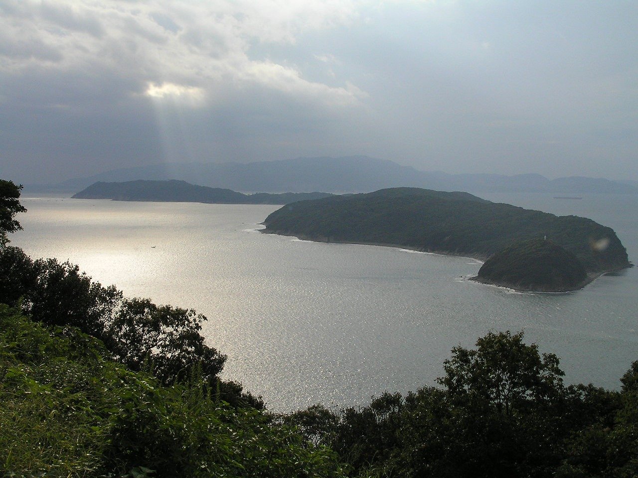
Hadasu and the Kumano coast — the shore of Nagi-Asu 熊野市・波田須と熊野灘の海岸
from Nagi-Asu: A Lull in the Sea 凪のあすから
in Kansai

What you will find
Nagi-Asu: A Lull in the Sea tells of children from a village under the waves attending school on land, and its surface town — a small fishing port on a ria coast of coves, tunnels and steep lanes — was modelled on the Hadasu district of Kumano, on Mie Prefecture's wild southern coast. The production's debt is visible in every establishing shot: the harbour arms, the terraced houses, the road threading the cliffs, and the particular grey-green of the Kumano-nada sea.
Hadasu is a hamlet, not a resort: a scatter of houses above a small port, where the anime's school-route lanes and sea walls stand much as drawn. Walk it quietly and briefly, then widen the day to Kumano itself — Onigajo's demon-carved rocks at the city's edge and Shichirimihama, the long gravel beach that runs for miles north, give the coast its full scale. This is the Kii Peninsula's dramatic shore, all black rock and open Pacific.
Visiting notes: Hadasu is a lived-in residential district; keep to public roads, keep voices down, and do not photograph into homes. Trains on the Kisei Main Line are few — plan around the timetable, and consider a rental car from Kumanoshi for the coast as a whole.
Facts
| Location | Kumano, Mie (Kansai) |
|---|---|
| Series | Nagi-Asu: A Lull in the Sea |
| Nearest station | Kumanoshi Station |
| Getting there | Kumanoshi Station (JR Kisei Main Line); the Hadasu district lies along the coast east of the city, reached by local bus or taxi. The wider Kumano coast spreads along the Kisei line. |
| On foot / last leg | Hadasu's lanes begin at its bus stop above the port; Onigajo is about 15 minutes on foot from Kumanoshi Station |
| Opening hours | Open at all times — public roads, coast and beaches |
| Admission | Free — public roads and coast |
Practical details checked on 9 November 2026 against official or official-tourism sources where shown. Hours and fees can change — the official site, where linked, is the final word.
About this place
Kumano (熊野市, Kumano-shi) is a city located in Mie Prefecture, Japan. As of 1 July 2021, the city had an estimated population of 16,232 in 8,746 households and a population density of 43 persons per km2. The total area of the city is 373.35 square kilometres (144.15 sq mi).
== Geography ==
Kumano is located near the southern tip of the Kii Peninsula, in southern Mie Prefecture, facing the Pacific Ocean. Parts of the city are within the limits of the Yoshino-Kumano National Park.
=== Climate ===
Background text: Wikipedia contributors, Wikipedia, CC BY-SA 4.0.
Keep exploring
Kashihara — Imai-cho's Edo streets and the shrine of the first emperor
Osaka — Hattori Heiji's city